Quality items from Bonanza’s top-rated sellers.

Surplus_4_Less' booth earned a 99.6% satisfaction rating for providing an excellent experience from start to finish. View booth >>

Rendered at 01:35:42 04/26/25
Full-size item image
Primary image for 1921 USGS Copper Printing Map Plates Drummond , MT set of 3 Topographic Survey
Item image 1
Item image 2
Item image 3
Item image 4
Item image 5
Item image 6
Item image 7
Item image 8
Item image 9
Item image 10
Item image 11
Item image 12
Item image 13
Item image 14
Item image 15

1921 USGS Copper Printing Map Plates Drummond , MT set of 3 Topographic Survey

£1,690.12 GBP
Ships from United States Us

Don't miss out on this item!

There is only 1 left in stock.

Shipping options

Seller handling time is 1 business day Details
No shipping price specified to GB
Ships from United States Us

Offer policy

OBO - Seller accepts offers on this item. Details

Return policy

Full refund available within 30 days

Purchase protection

Payment options

PayPal accepted
PayPal Credit accepted
Venmo accepted
PayPal, MasterCard, Visa, Discover, and American Express accepted
Maestro accepted
Amazon Pay accepted
Nuvei accepted

Item traits

Category:

North America Maps

Quantity Available:

Only one in stock, order soon

Condition:

Unspecified by seller, may be new.
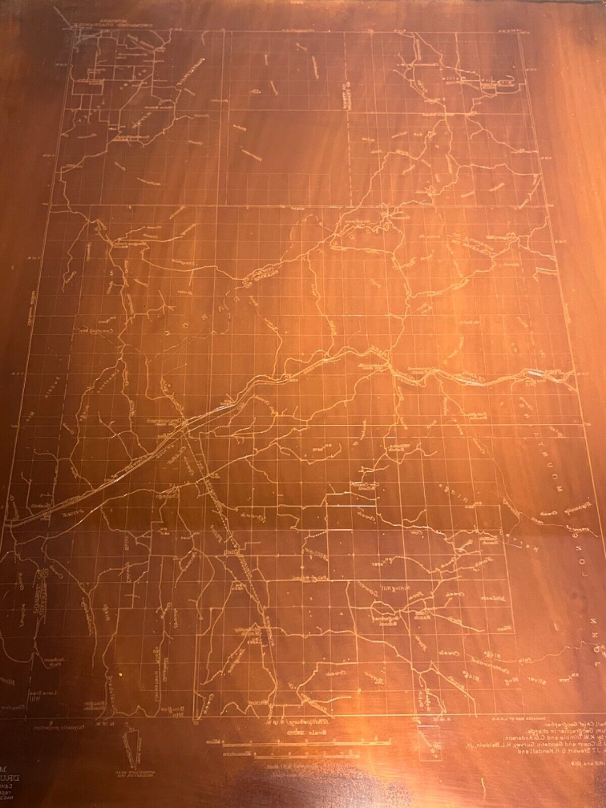
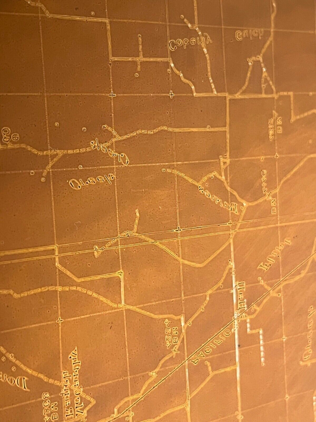
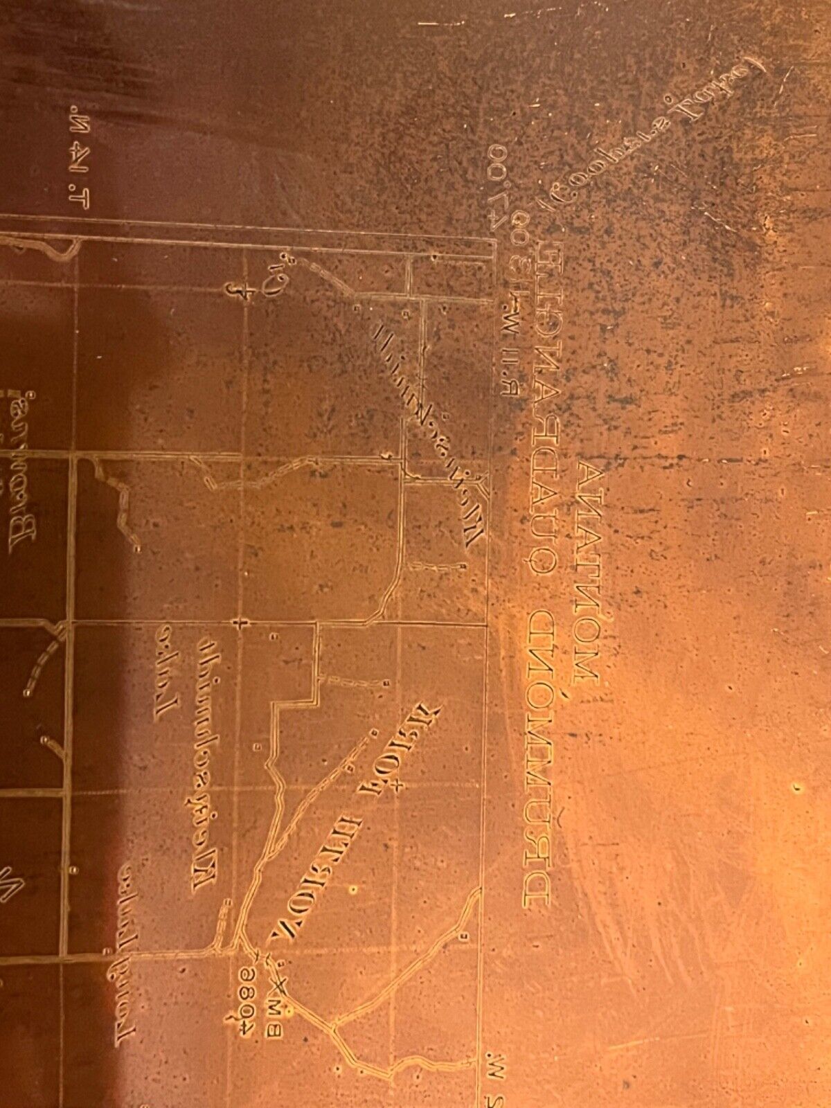
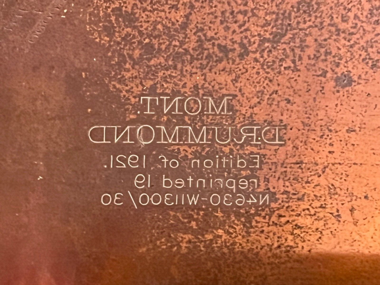
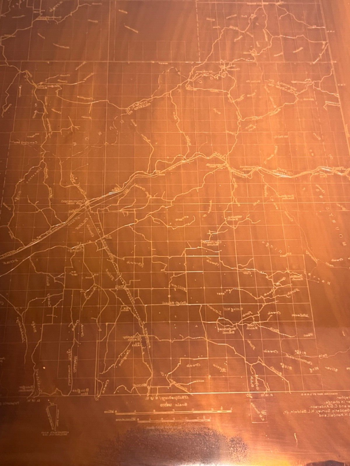
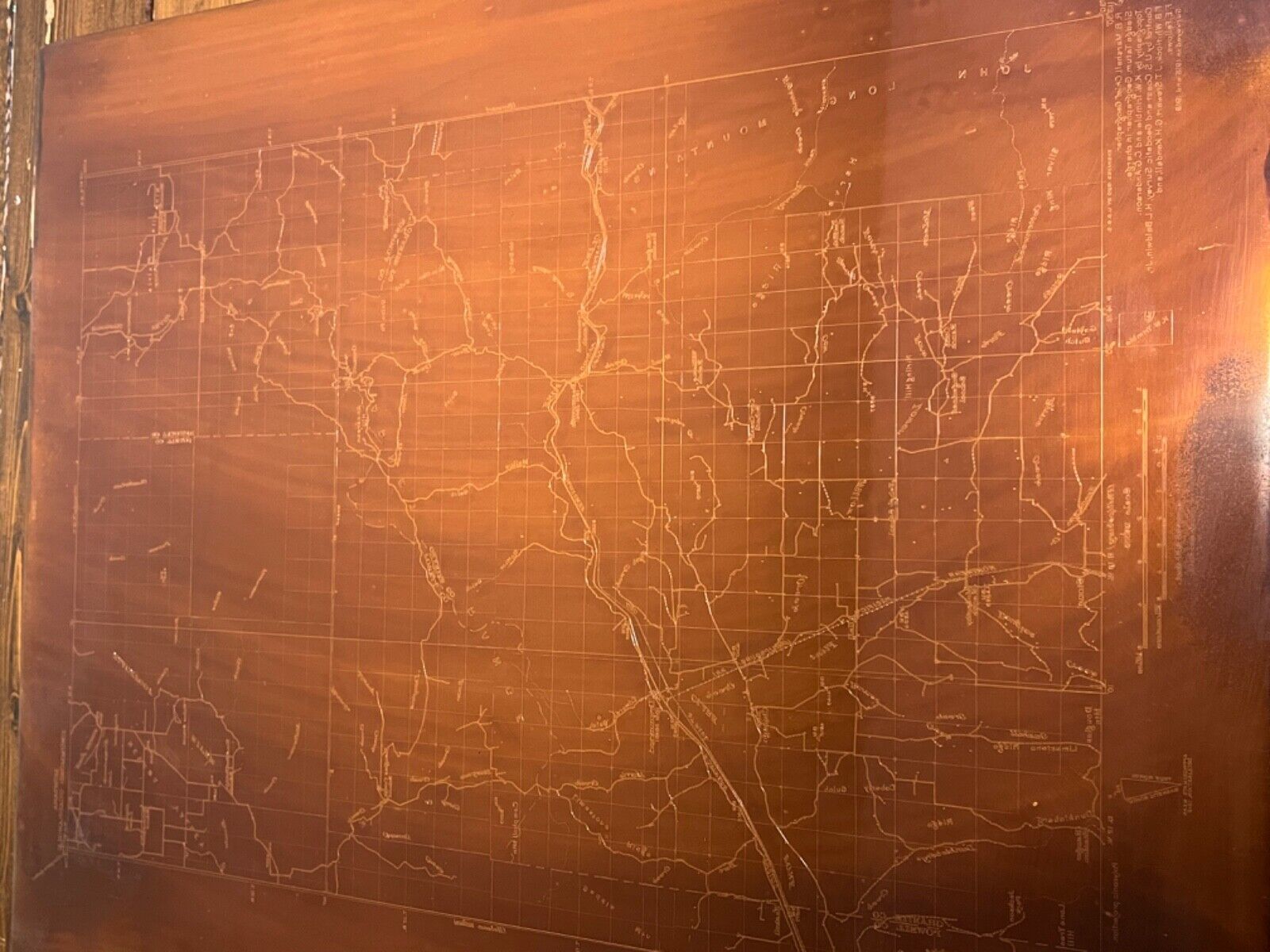
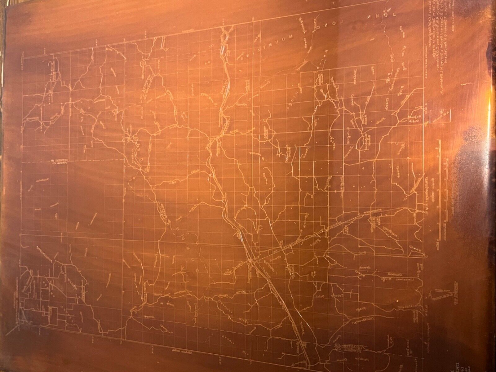
Type:

Topographical Map

Original/Reproduction:

Antique Original

Country/Region:

United States of America

US State:

Montana

Printing Technique:

Copper Plate

Listing details

Shipping discount:

Shipping weights of all items added together for savings.

Posted for sale:

More than a week ago

Item number:

1559257817

Item description

Listing is for one complete Set of 3 USGS copper plates Drummond, MT Montana Map etched in 1921 scale is 1:62,500 each plate weighs 12.5lbs and measures 17" by 21" One of a kind Antique History The last picture is a print of the 3 plates combine to make a single map. A Brief History of the Plates and USGS Map printing From the 1880s to the 1950s, the U. S. Geological Survey used engraved heavy copper plates in the process of printing many thousands of topographic and geographic quadrangle maps at several map scales. The Printing Process ? From Plates to Paper A complicating aspect of this historical USGS printing process is that prints were not directly made from the plates. USGS transferred the image from the engraved plate to a special lithographic stone in order to make large numbers of prints, an approach that preserved the crispness of the engraving. Otherwise, the accuracy of the engraving would have been lost due to the repeated pressure required to transfer the image directly from the plate to each paper copy. For printing purposes, the copper engravings were mirror images (left-to-right reversed). Etched by a USGS cartographic technician called a ?map engraver,? the words and text characters are backwards. For maps, ?east? appears on the left side of the plate instead of the right as it does on the printed map. The engraving plates for a topographic map were color-separated in a set; that is, there was a plate for each color of ink to be printed. A typical topographic quadrangle map had a set of three plates: a black ink plate for cultural features, boundaries, and most of the text; a blue inked plate for hydrography; and a brown ink plate for topographic contours.