Proseries Wall Map: Great Lakes (R) and 50 similar items
Free Shipping
PROSERIES WALL MAP: GREAT LAKES (R)
£200.15 GBP
View full item details »

Shipping options
Seller handling time is 10 business days Details
No shipping price specified to GB
Ships from
United States

Return policy
Replacement product available within 30 days
Details
Purchase protection
Payment options
PayPal accepted
PayPal Credit accepted
Venmo accepted
PayPal, MasterCard, Visa, Discover, and American Express accepted
Maestro accepted
Amazon Pay accepted
Nuvei accepted
View full item details »
Shipping options
Seller handling time is 10 business days Details
No shipping price specified to GB
Ships from
United States
Return policy
Replacement product available within 30 days
Details
Purchase protection
Payment options
PayPal accepted
PayPal Credit accepted
Venmo accepted
PayPal, MasterCard, Visa, Discover, and American Express accepted
Maestro accepted
Amazon Pay accepted
Nuvei accepted
Item traits
| Category: | |
|---|---|
| Quantity Available: |
Only one in stock, order soon |
| Condition: |
New |
| Country/Region of Manufacture: |
United States |
Listing details
| Seller policies: | |
|---|---|
| Posted for sale: |
More than a week ago |
| Item number: |
737233505 |
Item description
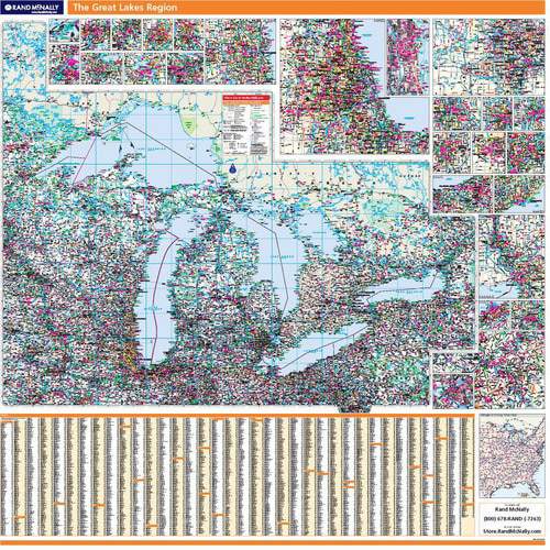
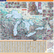
PROSERIES WALL MAP: GREAT LAKES (R)
DESCRIPTION
Rand McNally's ProSeries wall map of the Great Lakes area is ideal for anyone needing a comprehensive representation of the region for planning, routing, or reference. It's a great choice for business and sales strategy, urban development, social work outreach, education, and marketing.
Note: This map is not available for gift wrapping. Please allow 7-10 days for shipping. Copyright 2009.
Durable (3 mm thick) lamination for writing on and wiping off
Easy-to-read map with clear city and highway detail
UV-resistant ink to help prevent color fading
Inset maps of major cities (see below)
Comprehensive city index
Mileage chart and driving times map between main cities
Hanging kit with rails for easy mounting just about anywhere
Ideal for business, education, planning, or reference planning
Map indications include:
Interstates, federal highways, and state highways
Cities and towns
Major waterways, rivers, and lakes
State and national parks
National forests and monuments
Universities
Military installations
Airports
Major geographic features
COVERAGE AREA
Coverage area: E. Minnesota, E. Iowa, Wisconsin, N. Illinois, N. Indiana, Michigan, N. Ohio, Pennsylvania, W. New York, and S. Ontario
Inset maps: Duluth, Green Bay, Appleton, Cedar Rapids, Madison, Rockford, Quad Cities, Milwaukee, Chicago, Detroit
PRODUCT DETAILS
Map specs:
Dimensions: 60" x 60"
Scale: 1" = 17.5 miles
|
Why are we showing these items?
Search Results
Map, transportation"map" Category "Transportation"
Material
Handmade
Handmade
|


 - £34.97 GBP")


-
Refine your browsing experience
We can show you more items that are exactly like the original item, or we can show you items that are similar in spirit. By default we show you a mix.


This item has been added to your cart
 PROSERIES WALL MAP: GREAT LAKES (R) added to cart.
Only one available in stock
PROSERIES WALL MAP: GREAT LAKES (R) added to cart.
Only one available in stock
View Cart or continue shopping.
 Please wait while we finish adding this item to your cart.
Get an item reminder
We'll email you a link to your item now and follow up with a single reminder (if you'd like one). That's it! No spam, no hassle.
Already have an account?
Log in and add this item to your wish list.