Antique 1921 Southern France Map Europe and 50 similar items


Antique 1921 Southern France Map Europe Corsica Gulf of the Lion paper map
£16.20 GBP
View full item details »

Shipping options
No shipping price specified to GB
Ships from
United States

Offer policy
OBO - Seller accepts offers on this item.
Details
Return policy
Purchase protection
Payment options
PayPal accepted
PayPal Credit accepted
Venmo accepted
PayPal, MasterCard, Visa, Discover, and American Express accepted
Maestro accepted
Amazon Pay accepted
Nuvei accepted
View full item details »
Shipping options
No shipping price specified to GB
Ships from
United States
Offer policy
OBO - Seller accepts offers on this item.
Details
Return policy
Purchase protection
Payment options
PayPal accepted
PayPal Credit accepted
Venmo accepted
PayPal, MasterCard, Visa, Discover, and American Express accepted
Maestro accepted
Amazon Pay accepted
Nuvei accepted
Item traits
| Category: | |
|---|---|
| Quantity Available: |
Only one in stock, order soon |
| Condition: |
Unspecified by seller, may be new. |
| Type: |
World Atlas |
| Original/Reproduction: |
Antique Original |
| Date Range: |
1920-1929 |
| Year: |
1921 |
| Country/Region: |
France |
| City: |
Marseille |
| Format: |
Sheet Map |
| Printing Technique: |
Lithography |
| Seller Notes: | |
| Cartographer/Publisher: |
L.L. Poates Engineering Company |
| County: |
Tarn |
| Publication Year: |
1921 |
| State: |
Drome |
| Region: |
Europe |
| Topic: |
England |
Listing details
| Shipping discount: |
Shipping weights of all items added together for savings. |
|---|---|
| Posted for sale: |
More than a week ago |
| Item number: |
1699249196 |
Item description
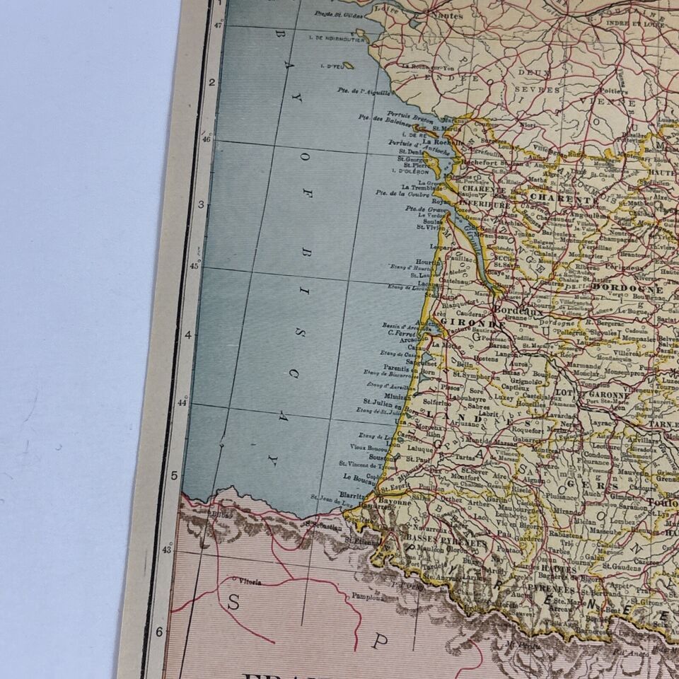
Explore the historical contours of Southern France with this antique map from 1921. Originating from the L.L. Poates Engineering Company, this lithographic print offers a glimpse into the past, detailing the region's topography and political divisions. The map highlights Marseille, Tarn, and Drome, providing a specific context of the era's Europe, including Corsica and the Gulf of the Lion.
As a part of a 1920-1929 world atlas, this sheet map is an authentic piece of history. Its publication year, 1921, makes it a valuable collectible for enthusiasts of antique maps or those with a keen interest in the cartographic representations of early 20th-century Europe. This map is a testament to the craftsmanship of its time and a noteworthy addition to any collection.


-
Refine your browsing experience
We can show you more items that are exactly like the original item, or we can show you items that are similar in spirit. By default we show you a mix.


This item has been added to your cart
 Antique 1921 Southern France Map Europe Corsica Gulf of the Lion paper map added to cart.
Only one available in stock
Antique 1921 Southern France Map Europe Corsica Gulf of the Lion paper map added to cart.
Only one available in stock
View Cart or continue shopping.
 Please wait while we finish adding this item to your cart.
Get an item reminder
We'll email you a link to your item now and follow up with a single reminder (if you'd like one). That's it! No spam, no hassle.
Already have an account?
Log in and add this item to your wish list.